On November 23rd a fire was reported in the Great Smoky Mountains National Park at Chimney Tops. This is a popular section of the park. Thought the trail is relatively short (just under 2 miles each way) there is an elevation gain of almost 1,000 feet the last mile up. The wildfire was human caused and under investigation.
This fire was relatively small at its inception but on November the 27th, the Monday after Thanksgiving, extreme winds began blowing embers over a large area and the fire began to grow rapidly. The resort communities of Gatlinburg and Pigeon Forge were particularly hard hit.
Reported wind speeds of over 70 mph coupled with the extreme drought conditions brought tragedy. As of this writing there are 14 confirmed deaths and 1,700 structures damaged or destroyed. The fire has burned over 17,000 acres. For a current status of the fire go here - http://inciweb.nwcg.gov/incident/5112/...
Disaster Gear Blog
Disaster Gear latest news, tips and products.
Blog
- Subscribe to this category
- Subscribe via RSS
- 14 posts in this category
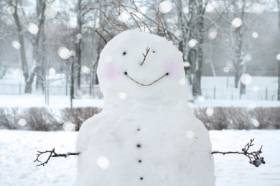 As owners of Disaster Gear, we have the opportunity to learn of various types of weather across the United States and around the world. As we are headquartered in the Southern U. S., we rarely get much winter weather beyond cold and wet. So, when a snow event is forecast we look on it with childish enthusiasm. The grocery store shelves are emptied of bread, milk and other essentials as if the Four Horsemen of the Apocalypse were descending upon us. Ok, maybe not that bad but you get my drift.
Our friends who live farther north take great delight in making fun of our inability to cope with a small amount of frozen precipitation. We always encourage them to come visit and see what it is like to drive on an elevated highway, frozen and "slick as glass" with no snow tires and no snow removal equipment. The best advice...
As owners of Disaster Gear, we have the opportunity to learn of various types of weather across the United States and around the world. As we are headquartered in the Southern U. S., we rarely get much winter weather beyond cold and wet. So, when a snow event is forecast we look on it with childish enthusiasm. The grocery store shelves are emptied of bread, milk and other essentials as if the Four Horsemen of the Apocalypse were descending upon us. Ok, maybe not that bad but you get my drift.
Our friends who live farther north take great delight in making fun of our inability to cope with a small amount of frozen precipitation. We always encourage them to come visit and see what it is like to drive on an elevated highway, frozen and "slick as glass" with no snow tires and no snow removal equipment. The best advice...
A tropical disturbance over the western Caribbean - Invest 97L is generating heavy rains over Jamaica and the Cayman Islands. More info here....
Tropical Storm Karen has formed in the Gulf of Mexico and will move into the southern United States this weekend with heavy rain, gusty winds and rough seas. Karen should make landfall somewhere along the Gulf Coast over the coming weekend. There is a chance Karen becomes a hurricane before making landfall. More detail here.
If you are at risk, make sure you have your hurricane preparations complete....
A tropical storm is moving in a westward path across the Atlantic and may become a hurricane within one day — which would make it the first Atlantic hurricane of the 2013 season. The first hurricane of the season usually forms by Aug. 10. Since the mid-1960s, the latest date for the first hurricane to form was set in 2002 when Hurricane Gustav formed on Sept. 11.
Tropical Storm Humberto’s maximum sustained winds climbed to 60 mph by 11 p.m. ET Monday, according to the U.S. National Hurricane Center. It may become a full-fledged hurricane Tuesday, the center said....


